Coastal land is constantly changing due to both environmental and human factors. Collecting coastal elevation data, both on land and in nearshore waters, helps to maintain up-to-date and accurate information so the impacts of storm events on our ever-changing coastal communities are better understood by government agencies at all levels, like FEMA, insurance agencies, scientists, and residents. The National Oceanic and Atmospheric Administration’s (NOAA) National Geodetic Survey (NGS) coastal mapping program requires accurate and current elevation data of the nation’s coastlines to provide regularly updated shoreline information for supporting maritime navigation, defining national territorial limits, coastal modeling, and managing coastal resources.
Topobathy lidar is typically employed as an accurate, efficient way to collect elevation data. These data, alongside aerial imagery, are used to extract vectors for generating shoreline data. This also provides a seamless topobathymetric data product for various applications within NOAA, such as maintaining shipping and navigation routes, and updating flood inundation models. We’ve recently worked with NOAA to acquire, process, and provide deliverables using aerial topobathy lidar and aerial imagery to help achieve these goals in Tampa Bay, Florida.
Our fi rm was the first private northern American company to own Teledyne Optech’s new Coastal Zone Mapping and Imaging Lidar (CZMIL) SuperNova lidar sensor, which provides a point cloud that contains elevation returns from aircraft down to the bottom of the sea floor, to include vegetation, buildings, water surface, submerged objects, and most importantly ground and submerged seafloor. We use a series of automated and manual procedures to classify these points appropriately with the end goal being the use of the points to designate the ground and create a precise digital elevation model.
Collecting coastal elevation data, both on land and in nearshore waters, helps to maintain up-to-date and accurate information so the impacts of storm events on our ever-changing coastal communities are better understood by government agencies at all levels, like FEMA, insurance agencies, scientists, and residents."
Emily Klipp
The Tampa Bay South Project
We have been a NOAA prime contractor for many years, and in 2021, NOAA selected us for the Tampa Bay South Shoreline Mapping project to collect topobathy data and aerial imagery along the bay’s shoreline and nearshore areas. This was one of the first projects we flew with a Teledyne CZMIL topobathymetric lidar sensor. This project proved the sensor’s capability to collect bathymetric bottom data beyond the existing capabilities of many of the other sensors on the market. It can achieve returns from deeper than the average sensor and helps in environments where standard topobathy sensors would not be able to collect data due to turbid waters.
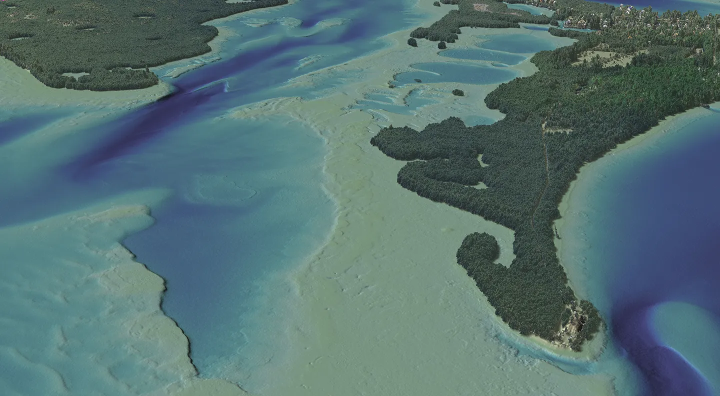 The Tampa Bay South Shoreline Mapping project proved the Teledyne CZMIL topobathymetric lidar sensor’s capability to collect bathymetric bottom data beyond the existing capabilities of many of the other sensors on the market.
For example, the original project boundary provided by NOAA intentionally did not include the middle portion of Tampa Bay because its depths went beyond the assumed range for normal topobathy lidar. However, in order to get full coverage within the project boundary, it was necessary for the flight plan to extend beyond this boundary in several areas, and we successfully achieved bathymetric bottom measurements of the seafloor in the deeper waters outside of the NOAA-provided boundary.
A Clearer Future
After completion of the Tampa Bay South project, NOAA requested the same sensor, due to the turbid environment, to map the Indian River Lagoon on the east coast of Florida. Additionally, we mapped an area further off shore in the Big Bend region of the Gulf of Mexico, where we were able to achieve almost full coverage out to six meters in depth. In order to achieve bottom returns, NOAA also requested we use the sensor on the Big Bend project because of the area’s location off shore and in deeper waters.
Our team continues to work with NOAA on similar projects across the U.S., including a large riverine topobathy project in Virginia. Because of previous success using the CZMIL SuperNova, our team is using it again so we can deliver a much clearer picture of elevation data in areas that were previously difficult to read.