Surveying deals with the process of determining the
three-dimensional positions of points and the distances and angles between them,
including limits of lots/parcels (boundary), landscape (topography), water
(hydrography), construction stake out, as-built, easement, and route/corridor
surveys. Geospatial manages and gathers data with a geographic or locational
component, using global positioning systems (GPS) and geographic information
systems (GIS) to collect, store, and display information in a spatial context.
It is easy to see how these services complement each
other. Geospatial technologies allow for surveying tasks to be completed
quickly and efficiently, and surveying can lay the groundwork to streamline
geospatial information gathering. This collaboration has proven successful in a
variety of our projects.
 Geospatial technologies allow for survey tasks to be completed quickly and efficiently, and surveying can lay the groundwork to streamline geospatial information gathering.
Collaborations in Florida
Our surveying and geospatial departments have partnered
on various projects across the state of Florida. One recent example is emergency
management topographic maps of different regions of the state. The maps were
created using lidar data, which were
captured by our geospatial team over four years. The lidar data gives heights
of objects on the earth, and surveying captures survey points and coordinates
to tie it all together for an all-encompassing final map. The geospatial team
also produced high-resolution digital elevation model (DEM) from the lidar data,
which helped provide high-accuracy, high-resolution topography data to the
state of Florida and U.S. Geological Survey (USGS). The data will be
beneficial in planning future infrastructure and economic development in Florida.
Geospatial technologies allow our team to gather large amounts of data very quickly. This greatly speeds up the surveying process—what geospatial can gather in one flight, a traditional survey could gather in a year.”
Jason Dolf and Jonathan Gibson
Another example is a land development project for 3,500
acres in Gulf County, Florida. For this project, our surveying team established
ground control of the site, while our geospatial team used a fixed-wing
aircraft and gathered lidar data to create a topographic survey of the site.
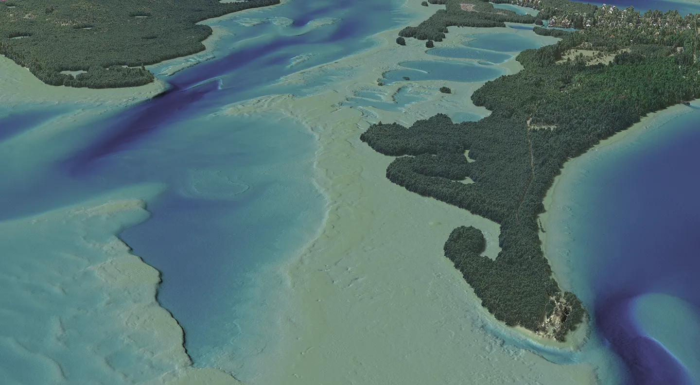 Our geospatial and survey teams collaborated to create topographic maps of the state of Florida.
Client Benefits
Together, geospatial and surveying services create a one-stop
shop for clients. Geospatial technologies allow our team to gather large
amounts of data very quickly. This greatly speeds up the surveying process—what
geospatial can gather in one flight, a traditional survey could gather in a
year. Additionally, geospatial processing techniques can greatly enhance the speed
at which some survey or mapping information is presented.
It is exciting to let
our clients know about the enhanced capabilities we offer, and we look forward
to more conversations on how we can combine geospatial and surveying services to
best benefit our clients.