Over its nearly 40-year history, the Coastal Barrier Resources Act (CoBRA) has been successful in achieving its goals of minimizing the loss of life; wasteful expenditure of federal revenues; and damage to fish, wildlife, and other natural resources associated
with coastal barriers. CoBRA has long been heralded as a market-based approach to conservation. An important step in solidifying CoBRA’s conservation legacy is the completion of the Hurricane Sandy remapping project, which includes the digitization
and modernization of the maps upon which the law is based.
The goal of the project was to accurately locate and map boundaries of the Coastal Barrier Resources System (CBRS), created by CoBRA, and to identify new lands for inclusion and remove lands that should not be included. Adoption of the revised maps produced
through this project will correct outdated mapping errors affecting more than 900 homes and other structures while at the same time adding hundreds of thousands of acres of qualifying relatively undeveloped areas to the CBRS.
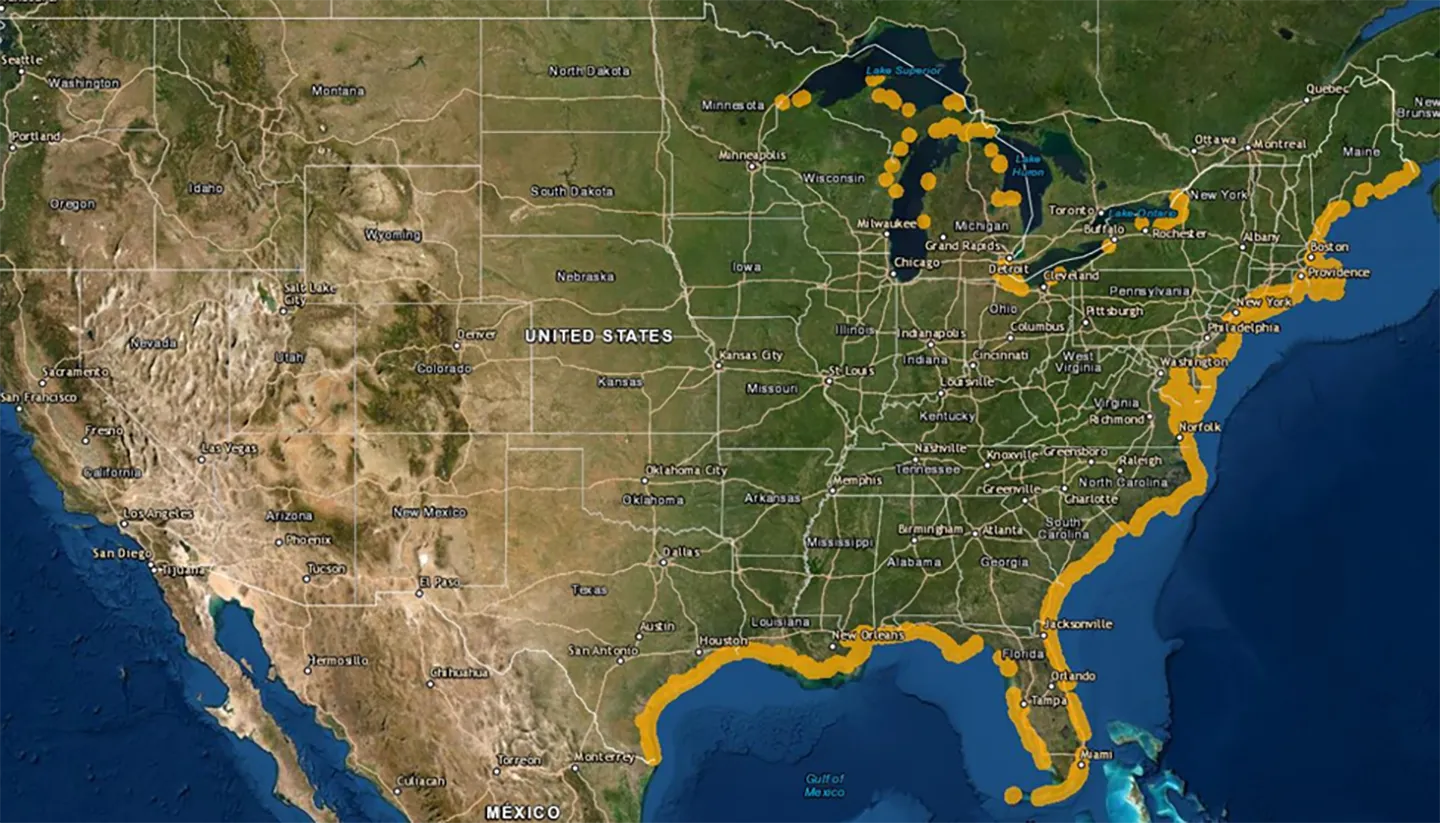 Coastal Barrier Resources System mapper showing where CBRS units are in the continental U.S. Image courtesy of U.S. Fish and Wildlife Service.
Perseverance Plays a Vital Role
The journey started back in the early 1980s shortly after former U.S. President Ronald Reagan signed CoBRA into law. This act designated over one million acres of undeveloped and vulnerable coastal areas as not being eligible for any form of federal financial
assistance—including flood insurance—for new development. The purpose was to discourage future unwise development in inherently risky coastal areas.
Because of the flood insurance prohibition, FEMA needed to show boundaries of the newly enacted CBRS on its flood insurance rate maps (FIRMs). In 1982, we had a contract with FEMA to create FIRMs and to add the CBRS boundaries to its FIRMs nationwide.
We served as the first contractor to put the boundaries on FEMA’s maps.
First Wave of Digital CBRS Maps
In 1998, we participated in a field exercise on FEMA’s behalf in the Outer Banks of North Carolina with the U.S. Fish and Wildlife Service (FWS). The exercise was to use GPS to precisely locate the CBRS boundaries in that area. We came back from
that exercise with a vision for modernizing CBRS mapping using evolving digital mapping protocols. In 2001, we were awarded a contract with the FWS to conduct a pilot project for Congress that demonstrated our proposed map modernization process. That
contract ultimately yielded the first digital CBRS maps as well as this 2008 report to Congress.
An Act of Congress
In 2015, we were awarded a $3.2 million dollar task order from the Congressionally appropriated Hurricane Sandy Relief Bill to turn the pilot project results into modernized CBRS maps for eight states hit hard by Sandy—Connecticut, Delaware, Maryland, Massachusetts,
New Jersey, New York (Long Island), Rhode Island, and Virginia. The project recently hit a major milestone with this 2022 report to Congress showing how the pilot project had set the stage for widespread modernization of the CBRS.
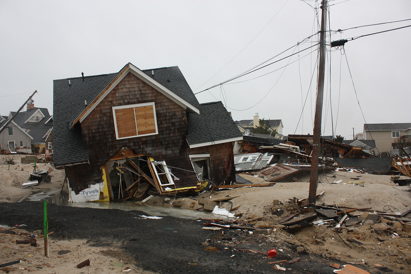
In the wake of Hurricane Sandy, we provided detailed research involving thousands of property owners to modernize maps for eight states and safeguard coastal communities.
Coastal barrier ecosystems are a critical natural mechanism for safeguarding coastal communities and coastal infrastructure. This project represented a major milestone in providing precise mapping for use in safeguarding long-term resilience."
Steve Kalaf
Safeguarding Coastal Communities
For this project, "quality" was defined as accuracy in researching land ownership and procuring reliable parcel boundaries. Any errors in boundary location could adversely affect private landowners that had developed their land before CoBRA was passed.
Our team completed the detailed research involving thousands of property owners, both private and public. Perseverance led to high-quality results for this Congressionally authorized project.
Oh! The Places Coastal Barrier Ecosystems Go
Coastal barrier ecosystems are a critical natural mechanism for safeguarding coastal communities and coastal infrastructure. This project represented a major milestone in providing precise mapping for use in safeguarding long-term resilience.
The impetus for this study was Hurricane Sandy, but the findings in the study are going to be just as relevant to the effects of sea-level rise as they would be to hurricanes.