My colleagues have shared in the past about the benefits of DimensionalView® and how we’ve used it to support our clients in other markets, but did you know the software has much more to offer, including to those in the geospatial and mapping world?
As a prime contractor on the National Oceanic Atmospheric Administration’s (NOAA) National Geodetic Survey (NGS) Shoreline Mapping contract, we are acquiring airborne topobathymetric lidar using the new CZMIL SuperNova sensor and aerial imagery
to enable accurate and consistent measurement of the national shoreline. The task order covers more than 600 square miles of Florida’s east coast to include the Indian River Lagoon (IRL) from Ponce Inlet to the north, down to Ft. Pierce in the south.
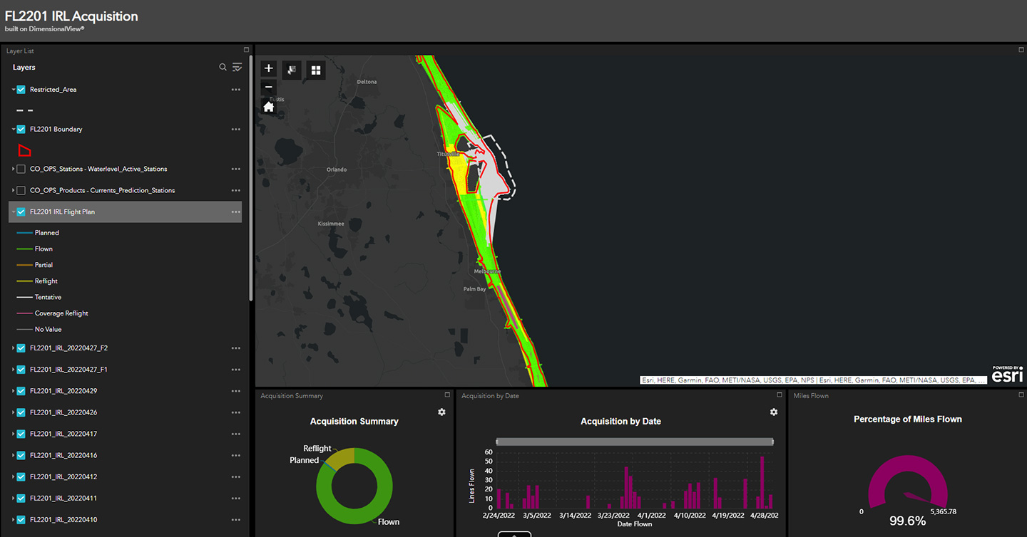
To help monitor and track the progress of the Indian River Lagoon project, we created a customized Esri-based project management tracker tool that provides easy visualization of quick-look products regarding the acquisition status of the project."
Emily Klipp
The tracker tool was built on DimensionalView—our GIS platform used to share data and maps with clients. The tool brings multiple points of data into one managed spot and fuses information with location to form an easy-to-understand dashboard.
Access the Tool Anywhere
The tracker is accessed by the project management team and the client via a secure URL, in any browser, and on various devices, including a standard desktop computer, tablet, or smart phone. With the click of a button, the information regarding acquisition
metrics becomes available, such as how many flights lines have been flown, how many need a re-flight, and how many are planned. Acquisition statistics by date and percentage of miles flown can also be shown.
Easy Visualization of Quick-look Products
The user-friendly format allows for easy display and navigation of the data. The layers can be toggled on and off and users can zoom to them with a right click or pan and scroll in and out seamlessly. There are also various base map options available.
Flexibility to Add More Information
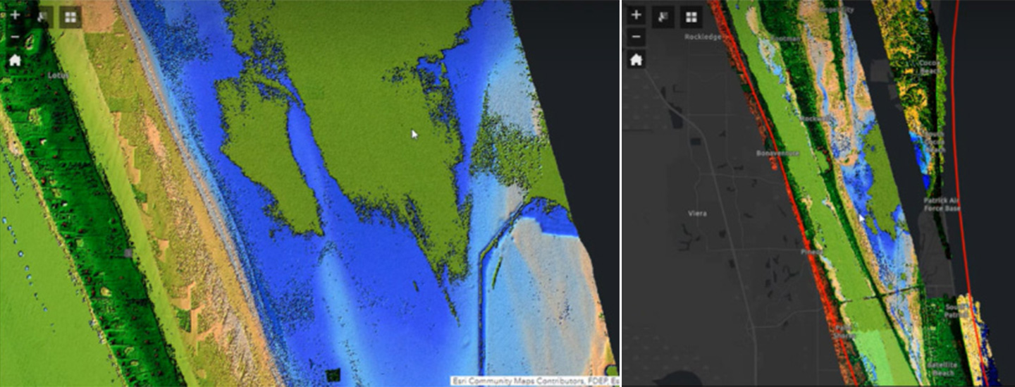
The tracker is flexible in its design and is easily customizable to accommodate additional features, including meteorological events, wind speed, and quantity of tiles completed. Nearly any geospatial layer that can be utilized in Esri’s suite of
products can be integrated into the tracker, allowing the project team and the client to dig deeper into understanding the project status. For example, coverage rasters, consisting of the lowest elevation of the point cloud, can be displayed in the
tracker. The data is processed just enough to confirm if the acquired data shows true bathy bottom data. This is important to understand to determine if a re-flight is necessary due to turbid water, algae, etc., or if the information collected is
sufficient.
Multi-use for Various Data Acquisition Methods
DimensionalView can be used for real-time tracking not only for topobathymetric lidar acquisition, but for acquisition of various data types acquired with a wide variety of sensors and platforms. The platform can be used for topographic lidar, sonar,
and aerial imagery to name a few. Another helpful layer that can be included in the portal are ground survey checkpoints, both for planning points and displaying final collected points.
The tracker is a powerful project management tool that combines numerous data points into one web-based location and then adds easy to use geospatial features allowing the user to access the information they need in the format they need.