Seagrass is an integral part of our oceans and not only provides shelter and food to an incredibly diverse community of marine life, but also improves water quality, reduces erosion, and buffers coastlines against storms.
Why is Seagrass Important?
Seagrass has a number of benefits not only to the environment, but also to the economy. Seagrass leaves absorb nutrients and slow the flow of water, capturing sand, dirt, and silt particles, while the roots trap and store sediment, which improves water
clarity and quality.
It also provides a habitat and food for many species from algae and bacteria to mollusks, fish, marine mammals, turtles, and sharks. Even dead seagrass supports a biotic community that thrives on the decomposing material.
Seagrass also helps water clarity, which is one of the draws for tourists to visit Florida’s beaches that feature crystal clear, blue water.
Economically, Florida’s 2.7 million acres of seagrass supports both commercial and recreational fisheries that provide a wealth of benefits to the state’s economy. Florida’s Department of Environmental Protection (FDEP) reported that
in 2000, Florida’s seagrass communities supported commercial harvests of fish and shellfish valued at over $124 billion.
How are we Mapping the Indian River Lagoon?
We’re currently mapping the seagrass in the Indian River Lagoon (IRL) on the east coast of Florida, which is a grouping of three lagoons, including the Mosquito Lagoon, the Banana River, and the Indian River. A primary objective of the IRL Surface
Water Improvement and Management (SWIM) Plan is to protect and restore seagrass. The IRL SWIM Plan directs the St. John’s Water Management District and South Florida Water Management District to map seagrass at two-year intervals to allow for
an ongoing trend analysis aimed at documenting seagrass distribution over time.
Seagrass helps maintain a clear aquatic environment and is a necessary component of the ecosystem.
The project includes obtaining time-sensitive aerial photography of the lagoon, fieldwork aimed at documenting seagrass habitats, time-series change analysis and photointerpretation, and the creation of a lagoon-wide ArcGIS map created from the aerial
photography and field work. Our team is currently completing aerotriangulation on the newly acquired aerial imagery and performing fieldwork in support of mapping and photointerpretation.
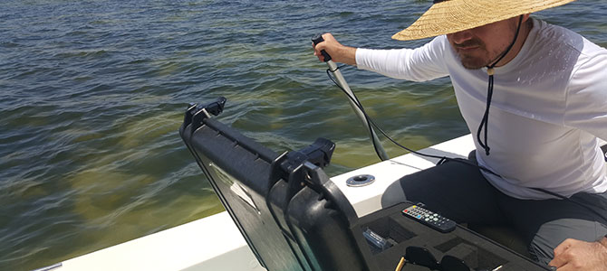
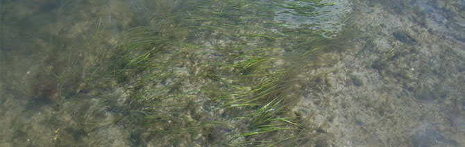
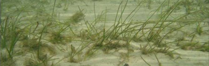
We sometimes have imagery that isn’t clear due to clouds, glint/glare, or turbidity, so we will go out in the field to see the area in question. Getting to do field surveys is one of our favorite parts about working on this project.
The Future of Seagrass
Overall, seagrass coverage in the IRL has declined due to the influence of human development, including stormwater runoff, excess freshwater inputs from drainage canals and flood control structures, along with a host of other impacts Overall seagrass
coverage has declined within the project area. For example, seagrass coverage in 2009 was approximately 80,000 acres while in 2017 coverage decreased by more than one-half to approximately 38,000 acres.
One of the ways we can help protect seagrass is avoiding seagrass beds when boating. Boating through a seagrass bed can kick up the dirt, sediment, and root structures that are keeping the erosion from occurring.
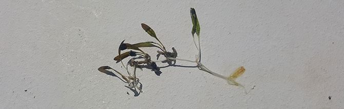
One of the many varieties of seagrass species we identified out in the field. We were able to confirm and dispute previously surveyed populations along the inlets during this field trip.
The Sea Turtle Rescue
Sometimes we have imagery that isn’t clear due to turbidity so we will go out in the field to see the area in question. Recently while we were in the field performing visual inspections of a questionable area, we noticed that there was a loggerhead
sea turtle that looked like it was in distress.
Our captain, Anthony Hernandez, was a previous employee of a sea turtle rescue center and he was the one who identified that the turtle was in distress. From there he contacted the Fish and Wildlife Conservation Commission (FWC) to get approval to bring
the turtle on board and take it to the dock. FWC then met us at the dock and took the turtle to the Loggerhead Marine Life Rescue Center where the turtle is currently being cared for.
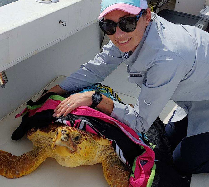
We used a wet towel to keep the sea turtle calm once we had her in the boat. She was a juvenile and only about three feet long and probably only nine to ten years old.
It was such a cool experience to have the chance to rescue a sea turtle while we were out performing field work. We’re glad that we were in the right place at the right time and had a hand in saving this animal.
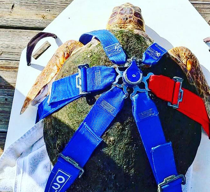
We met the FWC on the dock where they were waiting with a stretcher to take her to the Loggerhead Marine Life Rescue Center. The center named her Seiche.