Hydrographic surveying technology has advanced significantly in recent years. Today, with the use of drone technology in particular, surveys of drainage basins, streams, rivers, and reservoirs can be completed much more quickly, cost-effectively, and safely.
Efficient Technology
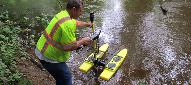
Dewberry is now frequently using drone boat technology, which obtains water depth by using either GPS or by linking to a robotic total station. Our portable, remote-controlled HyDrone-RCVs are a significant change from the more difficult and time-consuming process of finding access to a stream or waterway, then taking out a john boat to obtain elevations. First, the technology eliminates the need to get boat access to the water—a process that often complicates traditional hydrographic surveys. In some cases, access may not be available near the survey site, and may require permission from other landowners.

Second, instead of a three-person team, with one person on land and two in the boat, use of the drone requires only one surveyor. That person can stay on land, which reduces risk. In shallow water, the drone approach eliminates the need for a surveyor to enter the water, wrapped in a life preserver and surveyors' rope, to obtain the elevations while a second surveyor keeps a watchful eye from land. Drone technology also reduces the need for boat licenses and undergo extensive water safety training.
Multiple Applications
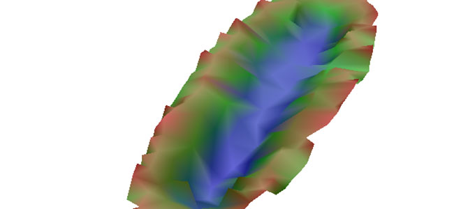
We have completed several projects using the HyDrone-RCV for hydraulic analysis. Under contract with Mercer County, New Jersey, we recently performed field survey work for a bridge replacement project using the HyDrone-RCV to determine the streambed and structure outline for the hydraulic analysis model. We set up a robotic total station outside of the roadway and under the bridge, then launched the drone boat with a 360-degree prism that the remote total station could use to take measurements. Using the prism helps when there is extensive tree cover. This approach produced a good cross-section of the stream, and we were able to create a detailed 3-D map for the engineers.
For another project, we were surveying a deep drainage basin on a mixed-use site. The basin was enclosed by a six-foot fence and the only access was through a four-foot-wide gate, so a john boat would not fit. This was the perfect application for a drone boat. We affixed a GPS receiver to the top of the drone and navigated it through the basin, collecting elevations every ten feet. This gave us a detailed look at the bottom of the basin.

There are limitations, as the drones cannot be used in water less than two feet deep, and they don't perform well in water with heavy currents. Generally, though, this high-powered, efficient tool, which sits atop catamaran pontoon hulls, is stable and reliable. The technology is another way we can better serve clients by providing hydrographic survey results safely, accurately, and more cost-effectively.