
July 19, 2012
Using Geospatial Technologies for Disaster Events
Catherine Bohn
As part of Dewberry's Disaster Cadre, my first deployment was in 1999, providing geospatial support of FEMA mitigation efforts after Hurricane Floyd.

Discover project, people, and trend insights and news, shared as videos, publications, press releases, podcasts, and blogs.
208 insights
July 19, 2012
Catherine Bohn
As part of Dewberry's Disaster Cadre, my first deployment was in 1999, providing geospatial support of FEMA mitigation efforts after Hurricane Floyd.
February 9, 2012
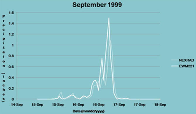
For watersheds with sparse stream gauge data and regulatory structures (as in reservoirs), watershed modeling remains the only method available to compute discharge values—although difficult to calibrate. Statewide regression equations published by the U.S. Geological Survey cannot be applied for…

February 2, 2012
Shandi Treloar
On Tuesday, February 7, at 10:15 a.m. CST, nine states across the central U.S. will participate in this year’s second annual Great Central U.S. ShakeOut. The drill will start when the National Weather Service sends a tone-alert to the NOAA Weather Radio. The radio will tell those listening to…

August 15, 2011
Update to 7.11.2011 blog: Above-Normal Hurricane Season for the Atlantic
Discover how our values, solutions, and years of experience come together to shape the built environment for our communities.

Our annual review and corporate social responsibility report, in one place.


Media and trade publications are permitted to use “Dewberry” as a shorthand to reference a particular Dewberry company. Third parties are not permitted to use Dewberry’s federally registered trademarks without Dewberry’s written consent.