Maricopa County Levee Emergency Action Plan
One of the First U.S. Levee Emergency Action Plans
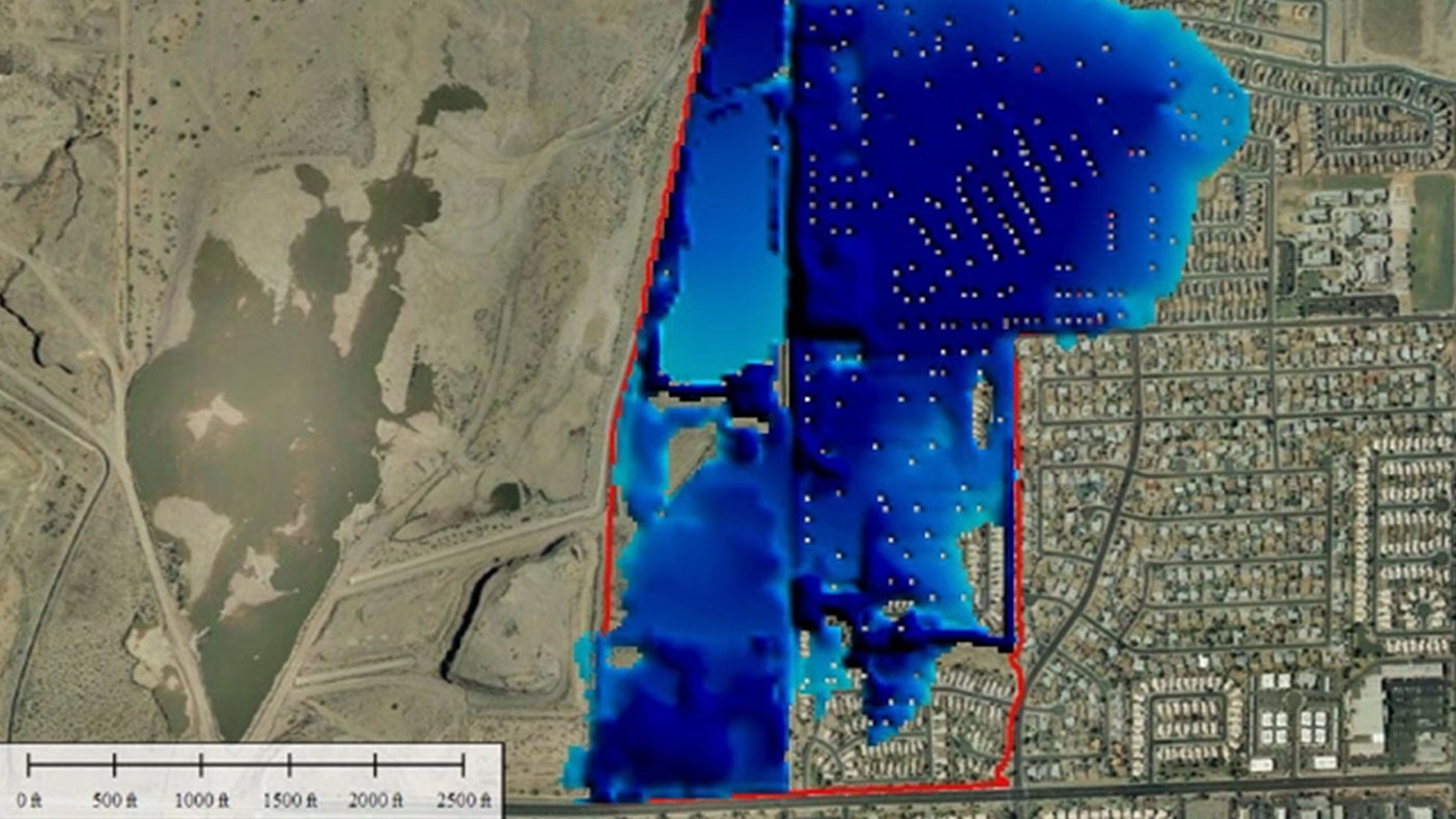
One of our EAPs used 2-D animation to display the depths of flooding in the inundation areas, in the event of a levee breach. Dark blue represents areas of greater flooding depth.
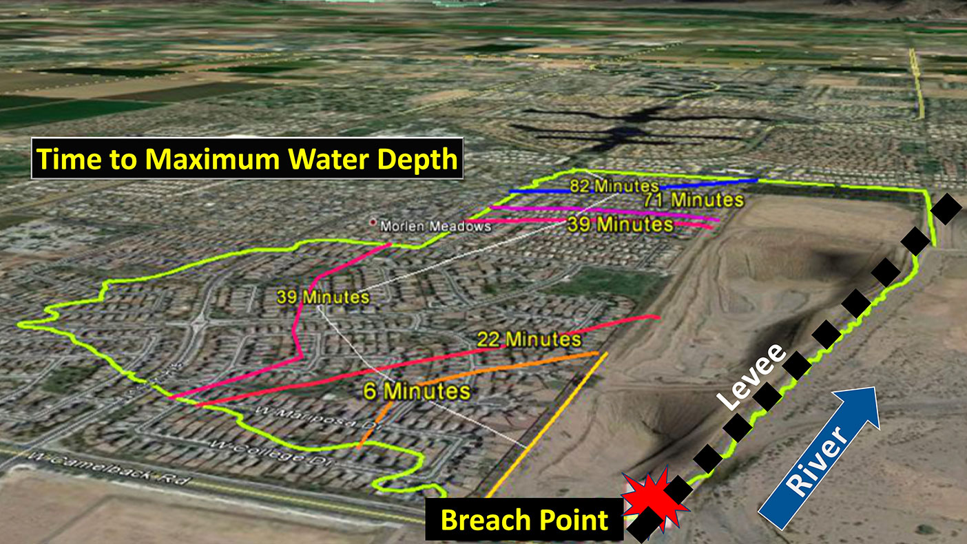
In the event of a levee breach, the amount of time it would take to reach maximum water depth varies depending on the inundation area. Our study concluded it could take as little as six minutes to reach maximum water depth for some homes.
- Client
- Flood Control District of Maricopa County
- Location
- Maricopa County, Arizona
- Services
- Planning, Consulting, and Advisory
- Completed
- 2012
- Region
- West
To meet the needs of emergency response and floodplain management officials in Maricopa County, contribute to the county’s ability to be a Class 4 CRS community, and to qualify the public for a flood insurance discount, we developed a template for Levee Emergency Action Plans (EAP) and tested it on two levees within the county.
We analyzed data on the depth, velocity, and travel times of water for several levee breaches to determine an evacuation area; then established proper communication and notification plans to be enacted by emergency and floodplain management officials.
Though dam EAPs are standard in the industry, this was one of the first levee EAPs in the U.S.
Related Projects
- Location
- Gaithersburg, MD
- Location
- New York, NY
- Location
- Nationwide
- Location
- Plant City, FL
- Location
- Nationwide

- Location
- Nationwide
- Location
- Louisa, VA
- Location
- Houston, TX
- Location
- Sacramento, CA