Real-Time Simulation (RTS) programs are designed to seamlessly integrate meteorological data; and reservoir operation simulation, hydrologic, and hydraulic models into a calibrated, comprehensive, and standardized program. The program is designed to assist system operators with maximizing operation of their reservoirs systems to meet their water supply, flood protection, and hydro-electric power generation purposes.
The U.S. Army Corps of Engineers’ Hydrologic Engineering Center-RTS
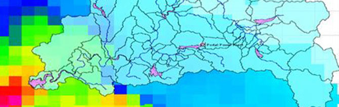
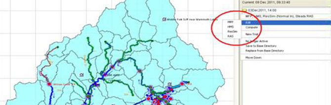
Developed by the Hydrologic Engineering Center (HEC) of the United States Army Corps of Engineers (USACE), the HEC-RTS program reads meteorological data from a variety of sources and inserts the data into a Meteorological Forecast Processor (MFP). The MFP formats the data for use by the model components, and the observed and/or forecasted temperature, snowpack, and precipitation data are input into the Hydrologic Modeling System (HMS) model. The HMS model reads the data and runs a simulation of snowmelt and/or rainfall runoff to model the hydrologic response of the watershed. It has the ability to:
- Predict whether precipitation will fall as rain or snow
- Track temperature of the snowpack to determine when snowmelt will occur
- Create inflow hydrographs to all defined reservoirs, diversions, pipelines tunnels and powerhouses in the system
Using a Reservoir Simulation Model
Minor reservoirs with simplistic operating criteria are modeled in HMS. However, larger reservoirs with complex operating criteria are modeled using a reservoir simulation model (i.e., HEC-ResSim or Riverware).
The reservoir simulation model includes spillways, controlled and uncontrolled outlets, pump stations, and power generation plants. Local inflows from the drainage area between the reservoirs are calculated by the HMS model and read into the reservoir simulation model. The ResSim model has the capability to route flows between reservoirs to balance the system. The flow in all streams and channels is stored in the HEC Data Storage System (DSS) database.
HEC-RAS models are used to input flow hydrographs and run unsteady hydraulic simulations through stream reaches between reservoirs. The operations model is used to determine whether water surface profiles and water level fluctuations are within acceptable limits. Output from RAS models can be used for mapping areas of inundation along modeled streams.
Availability of the HEC-RTS
There are a few programs that offer this comprehensive suite of Real-Time Simulation modeling options; the HEC-RTS will soon be available to the public and offers cost benefits, as well as the full-functionality and integration of the other HEC modeling products.