Our relationship with East Donegal Township's Water Authority spans nearly 70 years, and as technologies have evolved, so have our services. Project Manager Tom Ladue from our Carlisle, Pennsylvania, office, has been East Donegal's point person since 1972 and is a perfect example of the type of trusted, long-term relationship we like to develop. During a population boom in the 80s and 90s, Tom's engineering work was instrumental in the design of an updated water supply system, which consisted of expanding the original spring supply to two high-yielding wells. Over the years, he has seen the water authority's design and drafting advance from paper to linen to vellum to mylar to CAD, as well as assisted in the metering transition from manual to external readouts to electric.
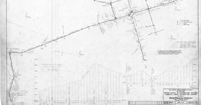
 Like many small towns across the U.S., East Donegal expanded municipal water and sewer services in the years after World War II. Pictured is the water supply and distribution plan from the 1940s.
Maturation of Our Legacy
The township's population has almost doubled within the past 15 years, and like many municipalities across the country, it's facing the challenges of aging infrastructure and a retiring workforce. In the face of these drivers, East Donegal's municipality directors realized the need to better manage data and to use the information to influence better decision making. The water authority contacted Dewberry to help create an inventory from its paper, CAD design, and as-built drawings, as well as develop a sustainable way of collecting, preserving, and accessing engineering and infrastructure information.
Our geospatial technology services team recommended using a geographic information system (GIS) framework to build a network, since it has the ability to combine the principles of organizing information geographically while leveraging a geodatabase to conveniently preserve, enhance, and access information. The water system information includes design and as-built information for pipes, valves and fittings, hydrants, and asset information used in planning and designing. By bringing all of these elements, including geometry, coordinates, and attributes together, the GIS network can create an interactive digital inventory for East Donegal's water system infrastructure.
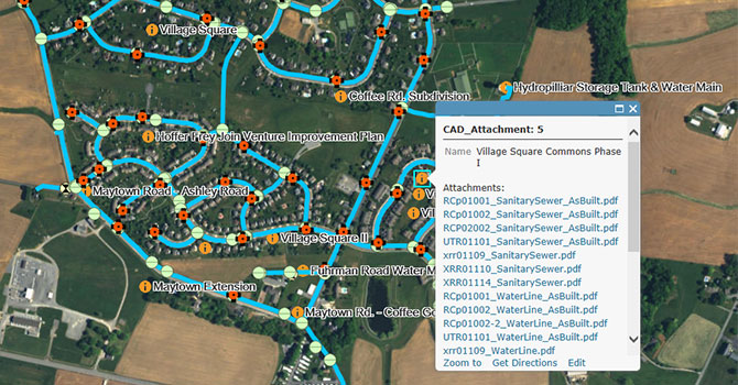
By enhancing Esri's Local Government Information Model, we created the East Donegal Water Utility Network, which provides easy access to data at any time or place from any web browser. More importantly, water authority staff will have the ability to use ArcGIS online with smartphone applications in the field, allowing them to collect and store important asset information in real time.
 With the implementation of the new East Donegal Water Utility Network, legacy plan information is accessible from any web browser.
Moving Forward
As organizations mature and become increasingly complex, the need for information management grows. While each client forges a unique GIS path, we work to help right-size their use of GIS in a way that matches their particular service and project requirements. While we continue to support East Donegal's water infrastructure needs, we're excited to see how the platform we designed will sustain the water authority well into the next 70 years.