In the aftermath of Superstorm Sandy, the Federal Transit Administration (FTA) announced a competitive grant program for projects aimed at increasing the resilience of public transportation systems against future disasters. FTA set aside nearly $3.6 billion for this competitive resilience grant program from a total allocation of more than $9.3 billion for response and recovery needs resulting from Sandy.
To help justify which projects were to receive funding, the FTA selected Dewberry to develop a Hazard Mitigation Cost Effectiveness (HMCE) tool. As a developer of many computational techniques employed in FEMA's Benefit-Cost Analysis tool, I was asked to be part of the tool's development team.
At the request of end-users trained on the HMCE tool, we also began developing the Coastal Flooding Recurrence Interval Calculator to estimate the recurrence interval of flood elevation levels recorded during Superstorm Sandy. The FTA challenged us to also consider the impacts of future sea level rise (SLR) in the auxiliary tool's calculations, which we did by taking into account location, SLR trend, and the expected useful life of a facility.
However, I wasn't completely satisfied with the way adjustments were being calculated.
Good Research Doesn't Stop After the Project is Complete
The final version of the calculator did indeed allow users to see just how SLR would impact results, but I felt the method we were using (suggested in a late 2013 FEMA memorandum) could be improved.
After further research, I came up with a way of integrating SLR impact on coastal flood elevations that keeps future flooding risk levels equivalent with current standards and avoids underestimating or overestimating future risk levels.
I called this method the Equivalent Risk Method.
The Equivalent Risk Method: A Technically Sound Method to Consider the SLR Impacts
To test the Equivalent Risk Method, I applied it to six coastal points in Maryland:

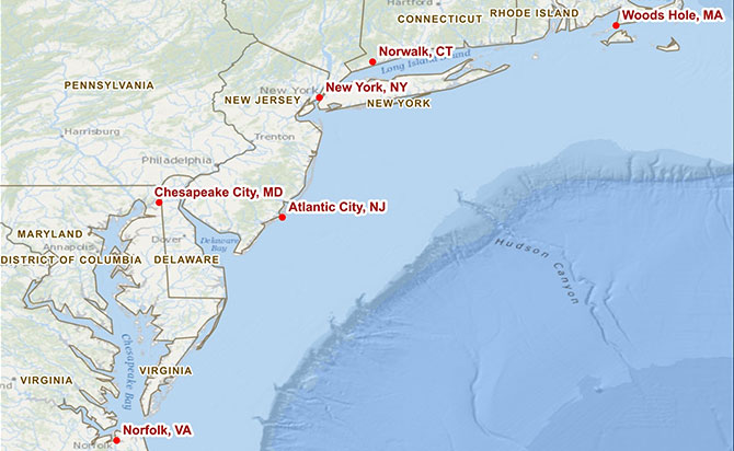
The method produced statistically accurate results, so I expanded the range to include six locations along a 600-mile stretch of coastal communities:

The second test produced similarly accurate results, thereby allowing coastal communities to deal with SLR challenges in more exacting ways.
I'm excited to say that the Equivalent Risk Method is being considered for application in a number of future SLR projects, and it's our hope that it will be integrated into a future Coastal Flooding Recurrence Interval Calculator update.