What is Base Level Engineering?
The Federal Emergency Management Agency (FEMA) is required to validate Flood Insurance Rate Maps (FIRMs) every five years. Flood hazard information is reviewed to determine if the built environment or expected flood flows have changed since a previous
study was performed. Engineers are now using Base Level Engineering (BLE) to prepare broad and accurate flood risk information for FEMA and communities nationwide.
BLE is a watershed-wide engineering modeling method that uses high-resolution ground topography, automated model building techniques, and manual model review. It’s similar to legacy approximate modeling, however, BLE allows an engineer to perform
large-scale modeling in a fraction of the effort. A significant portion of FEMA’s national flood hazard inventory is currently considered non-model backed or based on outdated techniques with no supporting data. BLE provides the modeling needed
to assess these unknown and unverified flood hazard areas.
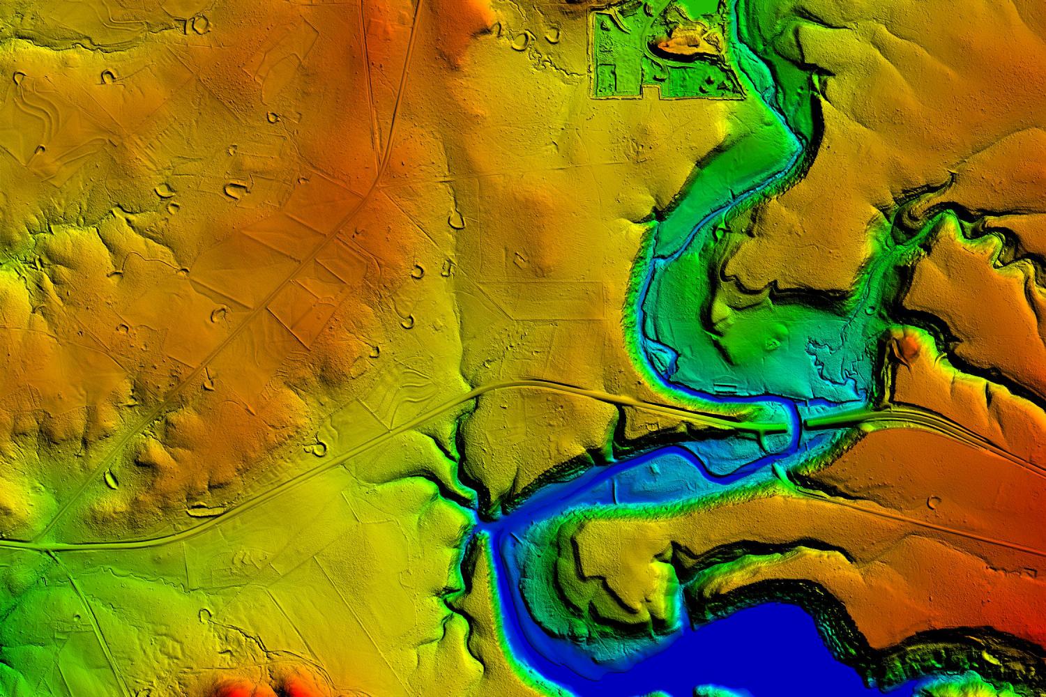
High-quality lidar allows for more comprehensive modeling and mapping techniques.
Benefits
BLE is a time efficient and cost-effective method of assessing flood hazard information. Engineers can gather the data and create a model that can be shared with the public at a much faster rate than the previous legacy studies. The high-quality elevation
data provides the foundation for more technically credible flood risk identification and can be further refined for more detailed analysis. Leveraging this high-quality topo data and using improved technologies such as 2D hydraulic modeling software
has significantly improved the accuracy and quality of these flood studies.
A community can greatly benefit from using BLE to increase the availability of flood hazard information. FEMA Flood Zone A are areas with a one percent annual chance of flooding and a 26 percent chance of flooding over the life of a 30-year mortgage.
Since detailed analyses are not performed for such areas, no depths or base flood evaluations (BFE) are shown within these zones. However, a major benefit of BLE is obtaining an estimated BFE in these unnumbered A zones. It gives updated information
for property owners and renters to make informed decisions on purchasing flood insurance, because they know what the flood risk is for their property. New developments being built can also reference the data to assure new homes or businesses are built
with the lowest floor above the identified BFE. BLE models can be used as pre-project models for land developers and refined to add structures, culverts, and field survey information. The technology allows the developer to review the effects their
development will have on the surrounding area.
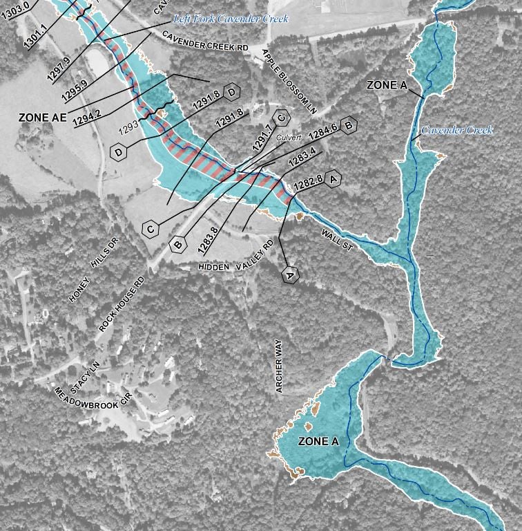
Zone AE has a BFE associated with it, but unnumbered Zone A doesn’t. A major benefit of BLE is obtaining a BFE in these unnumbered zones.
Challenges
Despite the many benefits of using BLE, there are some challenges that engineers, geographers, and communities face with this technology. Accuracy is one of the biggest issues, and working at such a large scale, it’s easy to potentially miss a large
bridge embankment, or maybe a smaller dam that could impede flows. Missing these features can produce artificially high water surface elevations on the upstream sides of the structures in floodplain maps and lower water surface elevations on the downstream
side.
As the data is reviewed, it’s important to check that the water surface elevation profile is consistent from upstream to downstream so that significant structures or topographic features are considered that may potentially negatively impact communities.
The Future
BLE has a bright future due to the fact that it is providing the best up-to-date knowledge of the flood risk for an area. These newer model-backed flood hazard areas are making an impact in the number of communities and homeowners purchasing flood insurance,
because the models mimic what they’re seeing in their day-to-day lives. FEMA’s Estimated Base Flood Evaluation Viewer is an interactive web portal that transforms thousands of models and data results into a few datasets to provide users
the ability to review estimated flood extents for a variety of scenarios. This technology is available using information gathered from BLE. This data is providing usable flood information to homeowners across the nation in a timely and cost-effective
manner and creating more resilient communities.
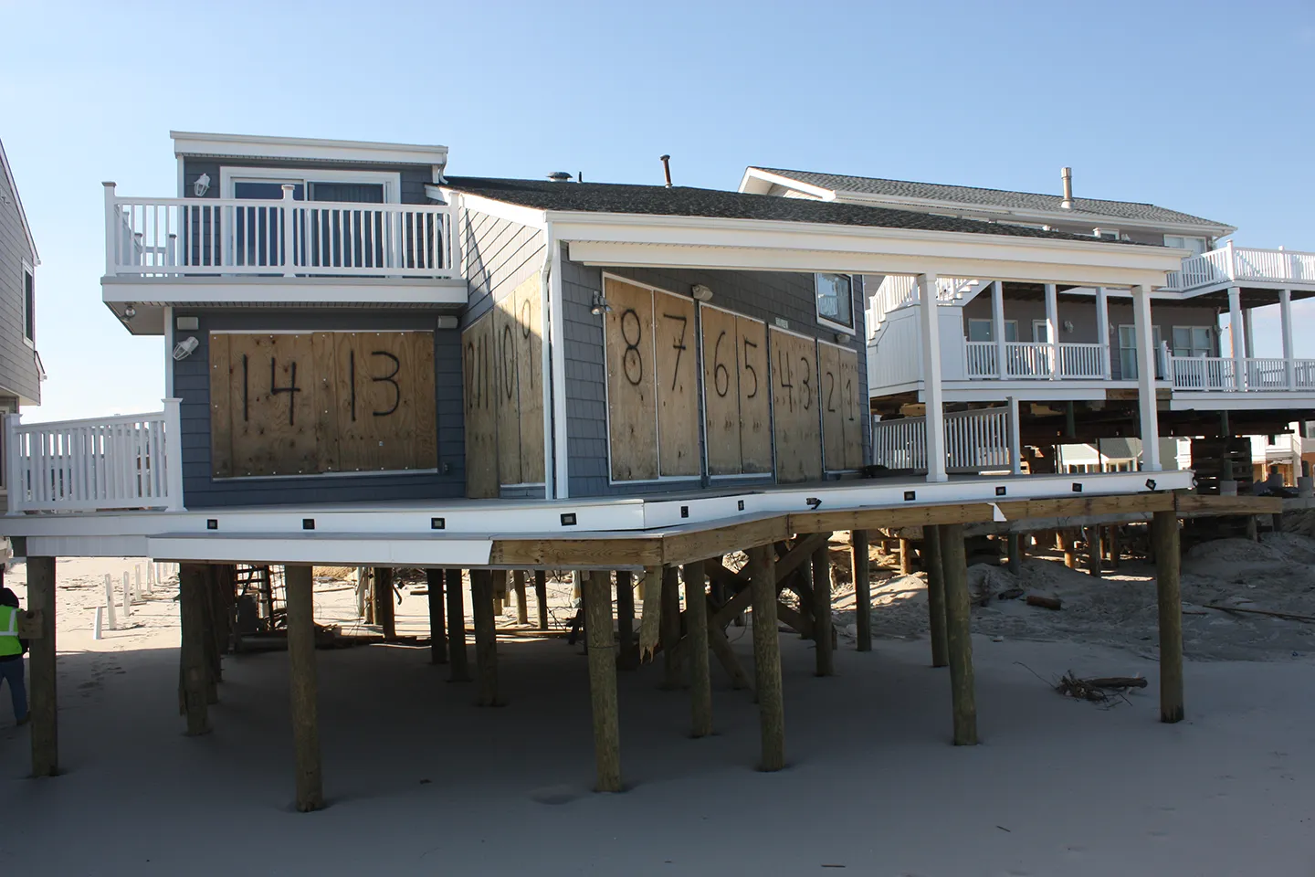
Homeowners and businesses can create more flood-resistant buildings, like building above the flood zone, with information gathered from BLE data.